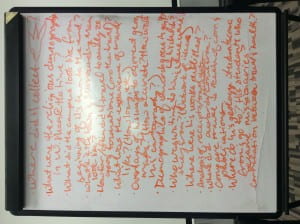
Forming, storming, norming, performing. We’ve got it down.
- HOW IT’S DONE: We’ve started learning the various methodologies used in DH – currently up to Omeka exhibits and geographical mapping. Each tool-learning experience starts with a little “evaluate these other projects that have used these tools” session in which we basically critique other projects, making notes about how what we should take from their example or do differently.
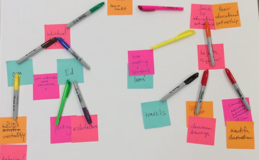
- OMEKA: After learning the tool with small demos, we proceed to write a bunch of concept maps and research questions. For the Omeka exhibit, this worked fine: 4 concept maps, one brainstorming session, and we had some topics. Although our facilities dealing with concept maps were exhausted, we had some idea of where we were going.
- Interestingly, the most fruitful discussions about research questions and concept maps come straight from the blue – from Kelcy’s “what if” questions and Daniel’s spontaneous tangents. One of these discussions arose during a concept map session (the last one, god bless). Someone suddenly asked, “What if we observe Ed and Orra’s achievements from a modern lens?” Suddenly, the tedious brainstorming (we had just done it so much in such a short time!) had an outcome – we had another point of view that created interesting questions we had not seen before. The “legacy” aspect of our project intrigued me the most.
-
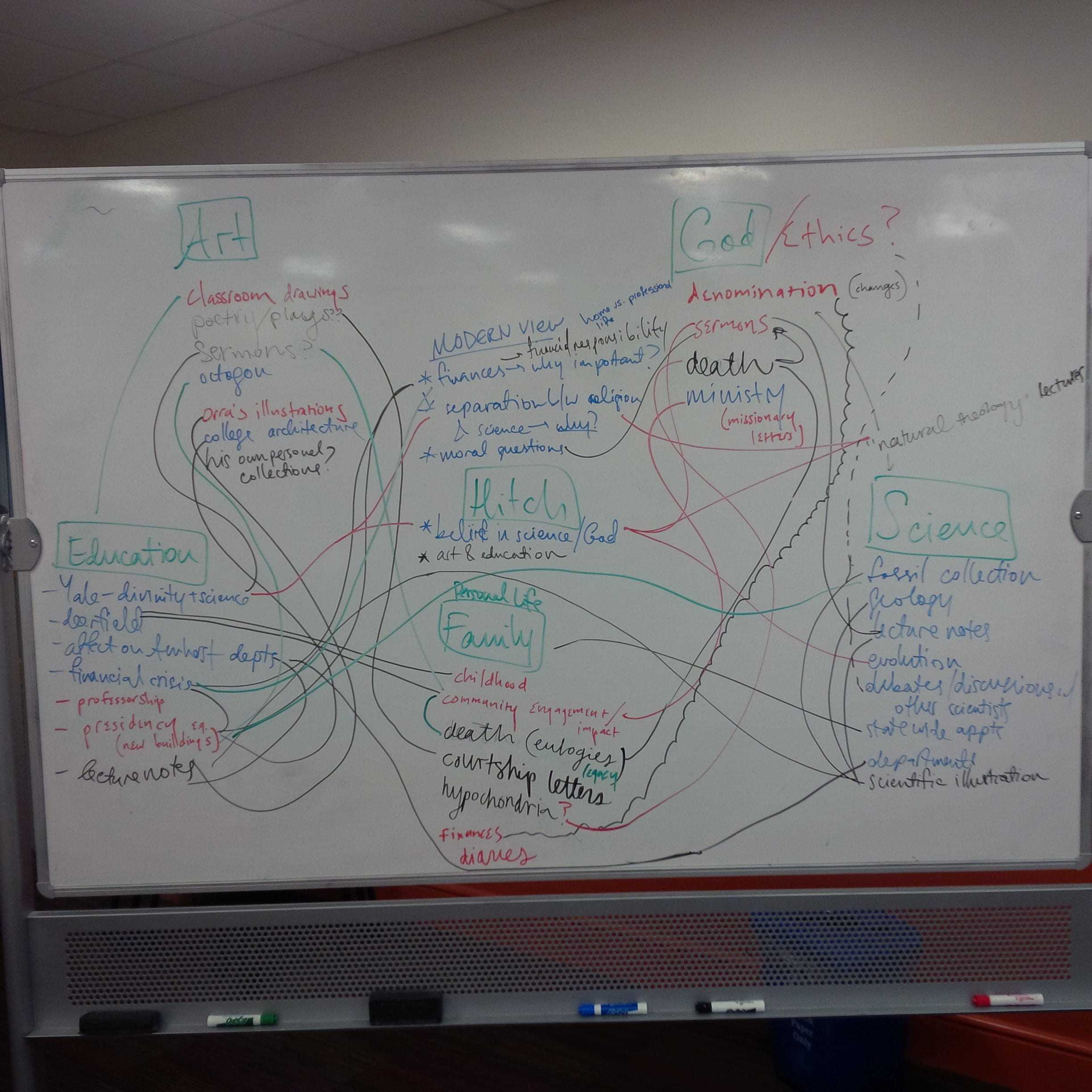
These are just two examples of concept maps – including the one we used to create the final exhibit prototype! 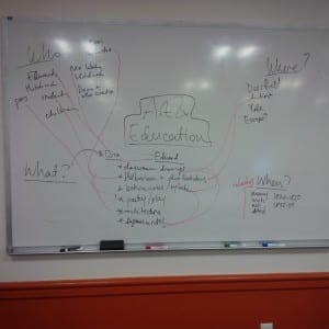
- For the Omeka exhibit prototype, we settled on a topic that arose from the “modern lens perspective discussion”: Ed and Orra’s impact on the interacting fields of Art and Education. The themes chosen were simple yet interesting: Edward, usually thought of as the scientist in the pair, had some projects of creative merit, and Orra, “accomplished artist,” was a trained and published botanist and scientific illustration. This role switch added another dimension to their characters – no longer were they known simply by their reputation.
- In addition, this topic choice – Art + Education – was perfect for a visual exhibit. We had the visual element in the title: art! We included as many images as we could for each of the respective pages we were doing.
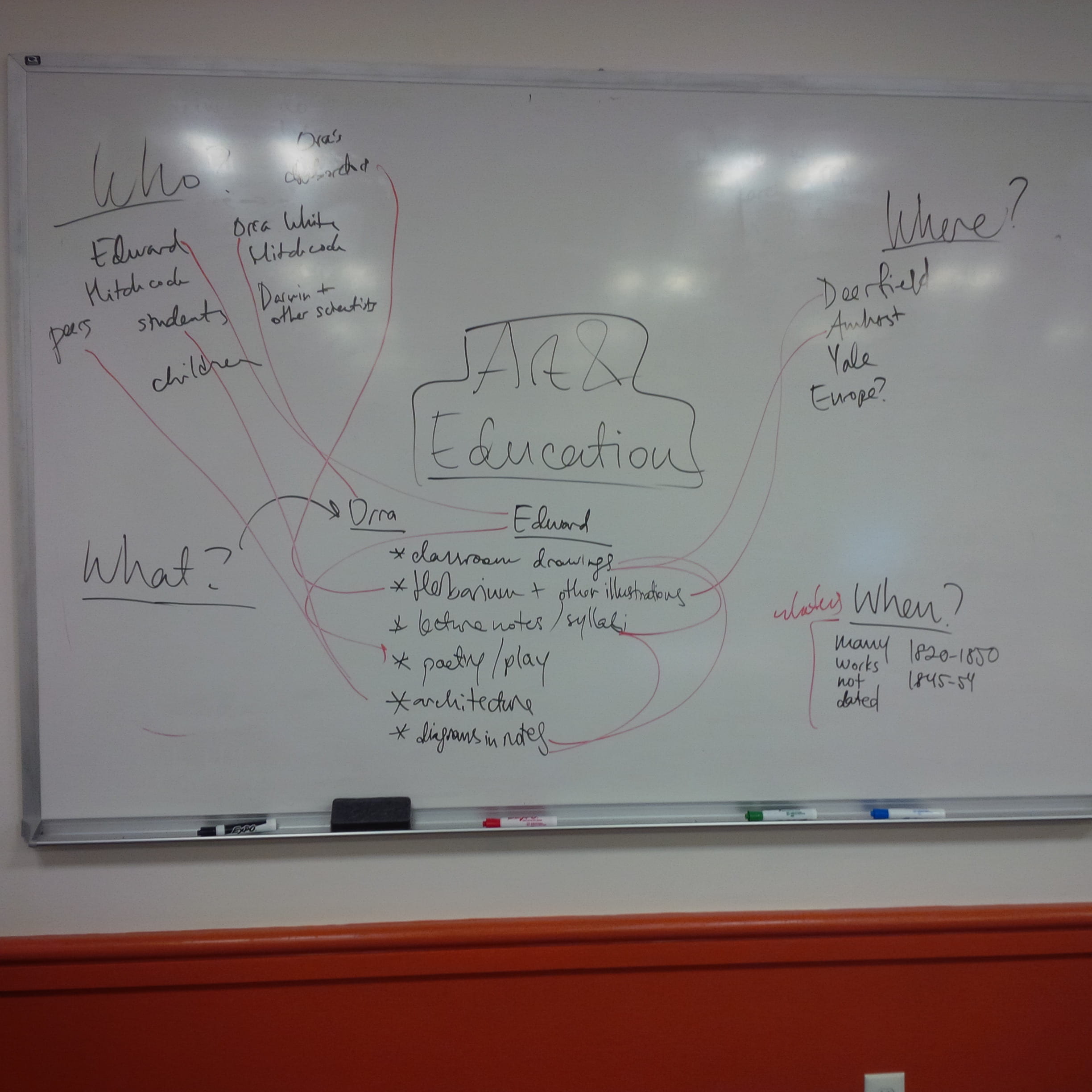
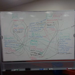
- During the session on actually creating an information architecture – where we basically create a site layout, with pages, subpages, themes, etc. The navigation for the site.
- I’m particularly really proud of how this worked out – the group came in at 9 am, threw our tired selves into this post-it note creation, and ended up with nothing. After a while of blank staring, I reshuffled the post-its into a cohesive format – Orra and Ed’s individual achievements on one side, Orra and Ed’s collaborative projects on the other, with more concrete pages stemming from those three broad categories. The end result had the unusually sleepy cohort blinking awake – look! here’s something that makes sense! B-) go me
-

The end result of our informational architecture machinations. AKA “should we draw lines or put markers or just leave it how it is?” - Here’s the end result for the Omeka workshop! (X) Not all the pages have content, but here is the one that I made: (X)
- MAPPING: Following the Omeka workshop was one on geographical mapping. Cool stuff. From the very beginning, I was particularly interested in mapping and maps and geography because what is more inspiring that the image of a world map? That view slowly eroded. The various mapping examples we looked at had me asking the same question: “Why are maps used in these situations? What does a map do that another tool couldn’t?” It was fairly disenheartening to see that a tool with such interesting potential had no use that I could concretely see (with the exception of http://worldmap.harvard.edu/africamap/ this one is an adventure with all its interactive content)
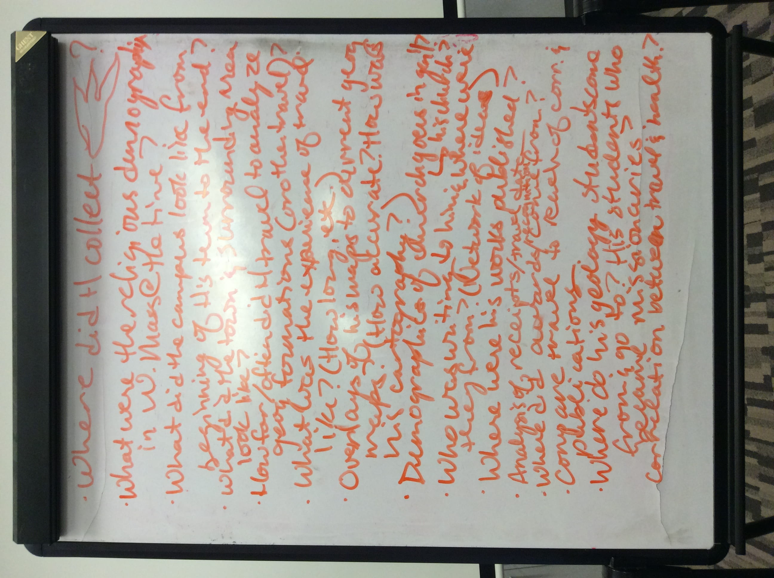
- We skipped the mapping process for the mapping protoype and went straight to research questions. The end result is a mess of questions, but the final one remains – what does the mapping tool add to any of these questions?
-
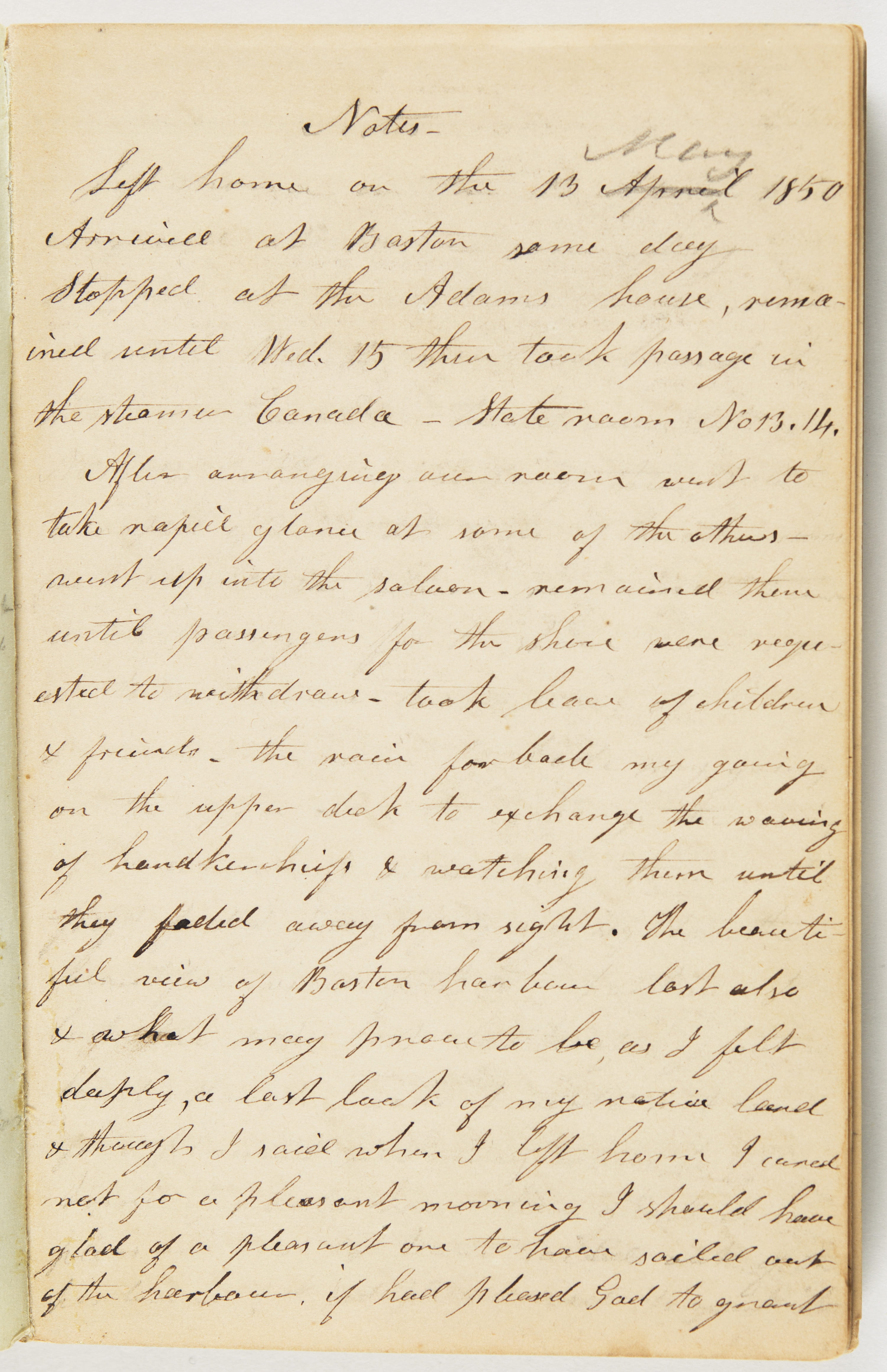
What an engaging mess. Fortunately, we actually had some interesting ideas spaced in here concerning the geographical aspects of the Hitchcocks’ legacy - We then split into two groups, making two prototypes. I was in the pair with Seanna that had to observe the movements of the Hitchcocks during their travels and plot them on a map using Orra’s diary entries. For this, we used TimeMapper, a simply and accessible tool (although some Harvard graduate gave it a 1-star review – “this is so simple! there arent enough options with this tool!” yes mister, that is the point – simplicity!)
- My partner had a health emergency, so I took on the diary entries myself. It was not easy.
-
“Don’t we have interns to do this tedious work for us?” say the interns themselves - Anyway, here’s my less-than-fruitful result. Sarah and Kelcy came over and the three of us together had a hard time getting this done, reading the locations and trying to find out the specifics with Google. “Is there a Gallahan Castle in Cologne? Which country is Cologne even in?” In the end, we knew more about the River Neckar than we ever needed to. Huge thanks to Sarah and Kelcy too – their help actually made my prototype exist. The prototype can be found here: (X)
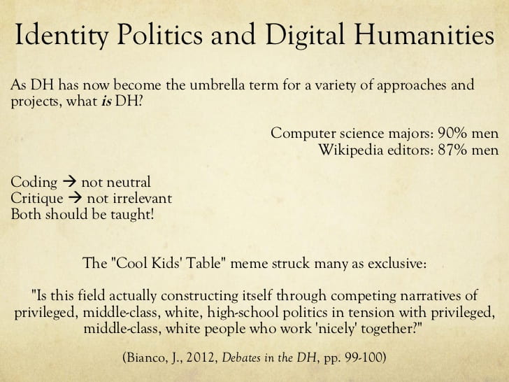
- LUNCHTIME: In addition, we met with the DH post-bacs. An interesting pair – Jeffrey Moro (his twitter is here) and Mariel Nyröp. They brought up some interesting points about the politics of DH, the various limitations that each tool and methodologies use. The idea is that every tool has a certain communication to it and requires thoughts and ideas to be delivered in that fashion, which may exclude people incapable to communicate in that manner. This was not a topic that we had discussed previously (although it was mentioned). That was my big takeaway from this lunch (other than the thought that people who are not official scholars also work in the DH field), but even then, the post-bacs themselves told us that “It’s like a filter. You have to decide when to turn on the politics and when to turn it off to actually get work done.”
-
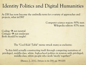
This was one of the first images on Google for “politics digital humanities.” It’s a fairly common topic in DH tbh (according to the post-bacs) - THE END: Otherwise, we’re working on the abstracts and methods for the last two projects, doing readings, living and breathing. Woohoo. Last Friday, Daniel turned on some music ridiculously loudly in the room. The day ended with some soft partying to songs that shouldn’t be repeated. This morning on the way here, Flavia (who is working in the Archives for the summer) held the door to Frost Library for me and said, “You guys were playing music so loudly that I was finishing shelving to ‘Trap Queen’!” Because that’s what we do in Digital Scholarship, DH, the DigiShip, Diggy Human Dept. We party and write and research. Rock on m/